Death Hollow Canyon
Posted in: Nature, Outdoor adventures, Special Places on September 23, 2020.
September is for Hiking
We just mentioned that September is one of the best months in which to hike in Southern Utah. It’s not so busy, it’s cooler, there’s no monsoon season – that’s are the condensed version of our reasoning. And since it’s September and since we’ve been thinking about hiking, we thought of another trial to talk about: Death Hollow Arch.
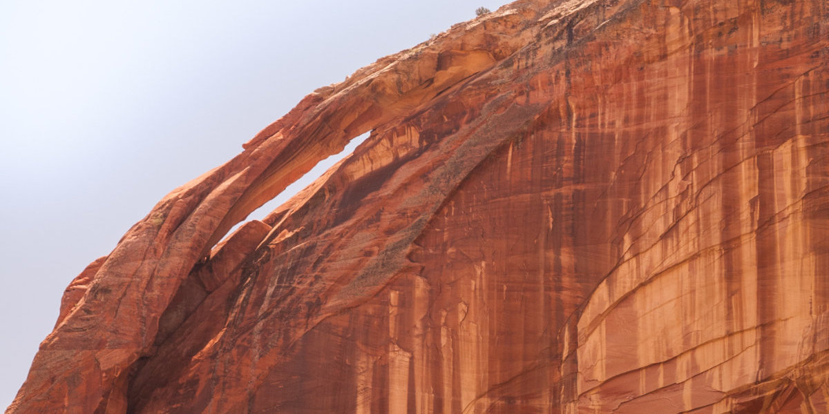
Death Hollow Arch. Photo by Glen Rushton via unsplash.com
Death Hollow Arch
Death Hollow is a region in the Grand Staircase-Escalante National Monument near the town of Boulder, Utah. It’s more wild, and less developed than other sections of the national monument and certainly more so than any of the national parks in Southern Utah. The hike to Death Hollow Arch is a backcountry trek, which makes September the ideal month to do it (see the cooler weather point above.) The trail leads over several miles of slick-rock mesa, to fantastic, scenic overviews, down into a desert canyon, up a narrow creek, and finally, to a really unique arch in a sandstone wall. It’s like all the best features of the Grand Staircase rolled into one great hike!
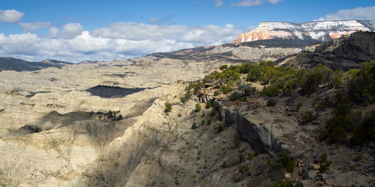
Views of the Grand Staircase-Escalante National Monument. Photo by Jim Witowski via unsplash.com
How to Get There
Okay, first things first, you gotta get to the trailhead. It can be a bit hard to find, since the pull-off isn’t super well marked. Luckily we live in the age of GPS! So head to coordinates 37°53’3.16“N 111°27’52.14”W . Or if you prefer, check out this link to Google Maps with the trailhead marked. You will have to access this trailhead by crossing a rural airstrip, so watch out for planes! (Don’t worry, it’s very unlikely that you’ll see any incoming air traffic.)
What to Expect
The trail starts at the old Boulder Mail trailhead. You’ll share the same route with the Boulder Mail Trail for about 3.5 miles. Follow the cairns over the slick-rock, and enjoy those amazing view! Eventually you’ll find the route down into to Death Hollow. Descend into the canyon and follow the river upstream for about 3 miles. You can’t get lost here, there’s only one way to go. Have fun splashing and wading as you make your way up the the river. And, after about 3 miles, the canyon will open up, and you’ll get to see Death Hollow arch. Rest up and head back the way you came. The whole roundtrip is 14 miles. And the trail is pretty strenuous, so make sure you’re up for it. Also, this particular trail is known for having plenty of poison ivy, so be prepared for that, know how to avoid it and how to treat it.

Be prepared to get wet. Photo by Daniela Andrade via unsplash.com
Camping
There’s a cool little camping spot called Ponderosa Camp near the entrance to the canyon. If you want to make this into a multi-day hike (a good idea if you want to spend more time exploring the area, or just don’t feel like you can do 14 miles in one go) bring along the tent and camping gear.
Safety, Safety, Safety
The hike to Death Hollow arch is in a very remote part of the state. And as such, you probably won’t meet too many other people on the trail. So it’s important to bring everything that you need for the trip with you. Like water. Lots of water. (Since there is a creek on this particular hike, a water-filtration system is also recommended.) We know it’s getting cooler, but you don’t want to be stuck in the desert without water. Also, be sure to tell someone where you are going, so that they can alert anyone if you run into trouble. Lastly, a good map is invaluable, so grab one of those too.